Moreau has published the boards and summary from its September 16 Route 9 open house. They outline possible mixed-use districts, shared driveways and infrastructure work. Separately, the Town Board’s draft minutes record a rezoning vote for specific parcels near Exit 17. Both are worth reading before making plans for a corridor property.
Updated October 10, 2026.
What the September materials add
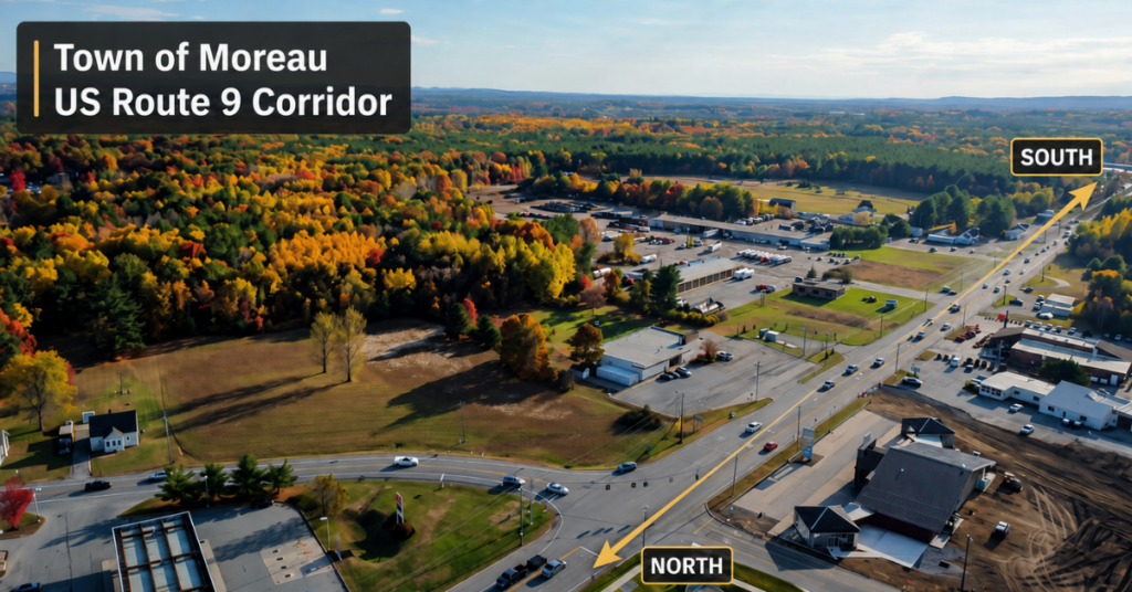
The open-house summary describes a primary study area from I-87 Exit 17 north to Butler Road, plus a secondary area extending south to roughly 500 feet beyond Old Saratoga Road. Together, they cover about 2.5 miles of Route 9.
The September 16 station boards show proposed Town Center Mixed Use and Town Center Commercial areas. They identify the Reynolds Road and Spier Falls Road intersections as places to concentrate future activity, with better walking connections. Other recommendations include shared driveways, connected parking and adjustments to zoning boundaries that currently split parcels.
The future land-use map remains a draft planning proposal. Zoning amendments, funding for public improvements and approvals for individual developments require separate action. Use the map to identify questions about a property, then check the rules and records that apply to it now.
A separate rezoning vote is already recorded
The Town’s September 22 draft meeting minutes record a unanimous vote to adopt Local Law 7 of 2026, covering the R-3 to C-1 rezoning of specified Garden World parcels near Exit 17. That parcel-specific action is separate from the corridor study. State filing and the effective date were not independently verified for this update; confirm the filed law and effective zoning with the Town for an affected property.
For any site, begin with its address and tax-map number. Ask the Building Department to confirm the district, lawful use and occupancy, and obtain prior approvals and conditions. Check the use schedule, frontage, setbacks, parking and loading requirements in Chapter 149, along with recent amendments. A commercial zoning label alone does not resolve the full site plan.
The Saratoga County property-research guide explains how to assemble assessment, deed, survey and municipal records into a property file.
Check how vehicles would enter and move through the site
The shared-access concepts matter because a useful commercial site needs more than road frontage. Review the existing driveway permits and any easements, then consider deliveries, customer parking, loading and emergency access. Connections to a neighboring parking lot may require an agreement with that owner.
Route 9 is a state highway. NYSDOT’s commercial-access guidance covers new or modified access, changes of use and development expansion. Ask about the permit process early enough to test the proposed layout. An initial review does not secure a driveway approval.
Get a property-specific answer on water and sewer
The September recommendations call for reconsidering sewer connection fees in the secondary study area and utility-extension requirements where barriers such as I-87 affect feasibility and cost. Those proposals are particularly relevant south of the interchange, but they do not establish a connection or price for an individual parcel.
Ask the Water & Sewer Department to confirm the service boundary, existing connection, available capacity, fees and approvals for the intended use. Have an engineer assess any required extension, pumping, fire flow and stormwater work. A pipe nearby is only the beginning of that inquiry.
What to watch next
The published recommendations also call for a broader environmental and infrastructure assessment and a capital improvement plan. For an owner considering redevelopment, the useful details will be the projects identified, their costs, funding sources and timing.
Follow the project’s meetings and materials page for further study documents, and the Town’s records for proposed legislation or adopted changes. Before valuing a site around a future use, identify exactly which step still has to happen and who must make that decision.
Sources
Sources checked October 10, 2026. Use current Town and agency records for requirements and parcel-specific questions.
- Moreau Route 9 study: meetings and materials Official project page, including September 16 open-house materials.
- September 16 open-house station boards Draft future land-use map, proposed districts, access concepts and infrastructure recommendations.
- September 16 open-house summary Study area, public feedback and the recommendations presented.
- September 22 Town Board draft minutes Resolution 335-2026 records the Local Law 7 adoption vote; minutes are marked draft.
- Local Law 7 proposed text Affected parcels and the provision making effectiveness dependent on state filing.
- Town of Moreau Building Department Parcel-specific zoning, permit and occupancy questions.
- Town of Moreau zoning code Chapter 149; check recent adopted amendments with the Town.
- Town of Moreau Water & Sewer Department Service and connection information.
- NYSDOT commercial driveway and access permits State-highway access review and permit guidance.
Own, lease, or evaluate property along Route 9?
Start with the parcel, permitted use, access and utilities.
This article provides general real estate information, not legal, tax, lending, environmental, engineering, inspection, accessibility, or investment advice. Requirements and property conditions vary. Confirm current information through the applicable public agency, transaction documents, and appropriately qualified professionals. Browsing, reading, or submitting an inquiry does not by itself create a brokerage, agency, fiduciary, or client relationship.